Eduard: Swiss-Style Relief Shading for Maps Using Machine Learning
We first published our paper on relief shading using neural networks towards the start of October 2020, and now almost 2 years later, we are very excited to share Eduard.
Eduard is designed to help cartographers create beautiful shaded reliefs for terrain maps. It uses machine learning (ML) models to create accurate Swiss-style shaded reliefs, which can be customised to adapt to your terrain.
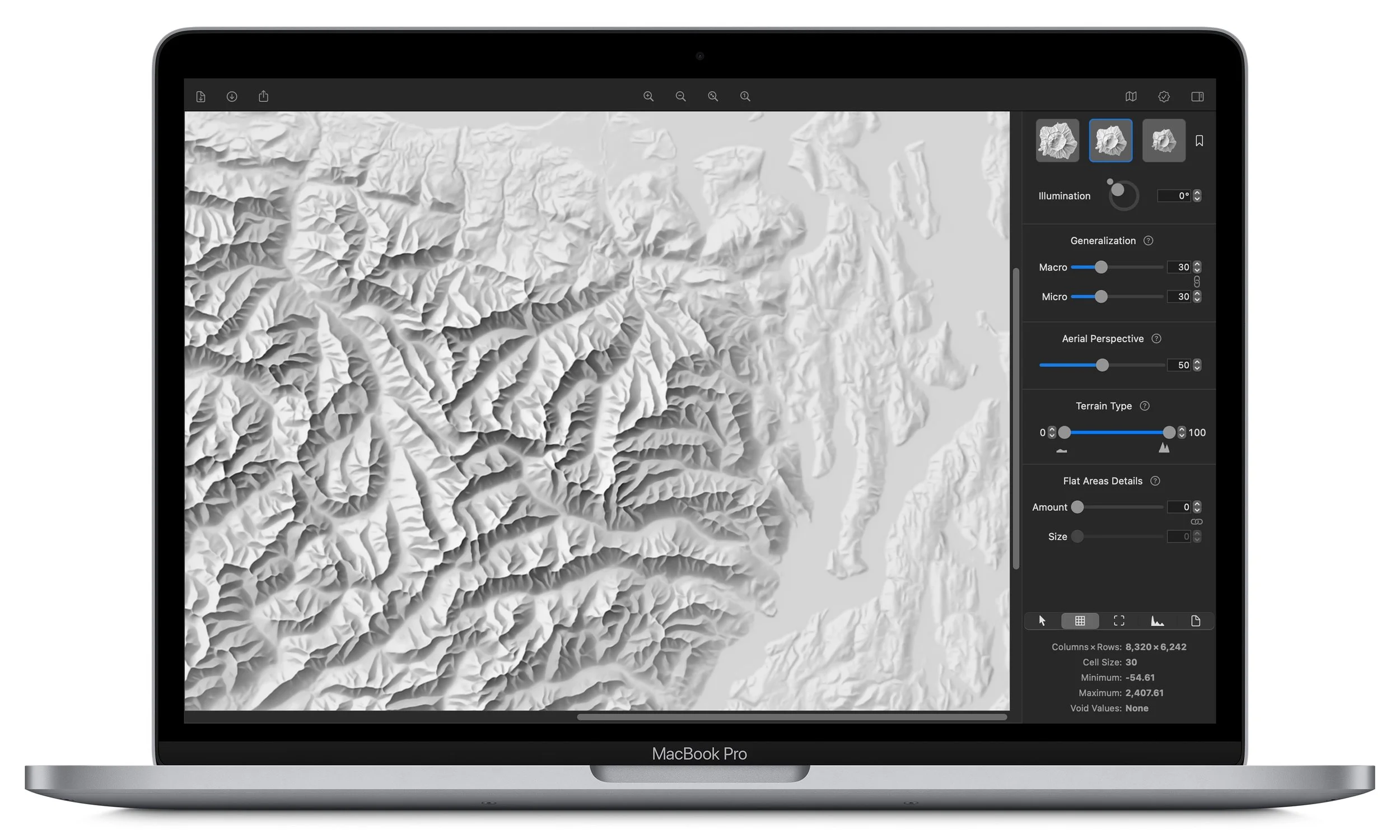
In Eduard you can:
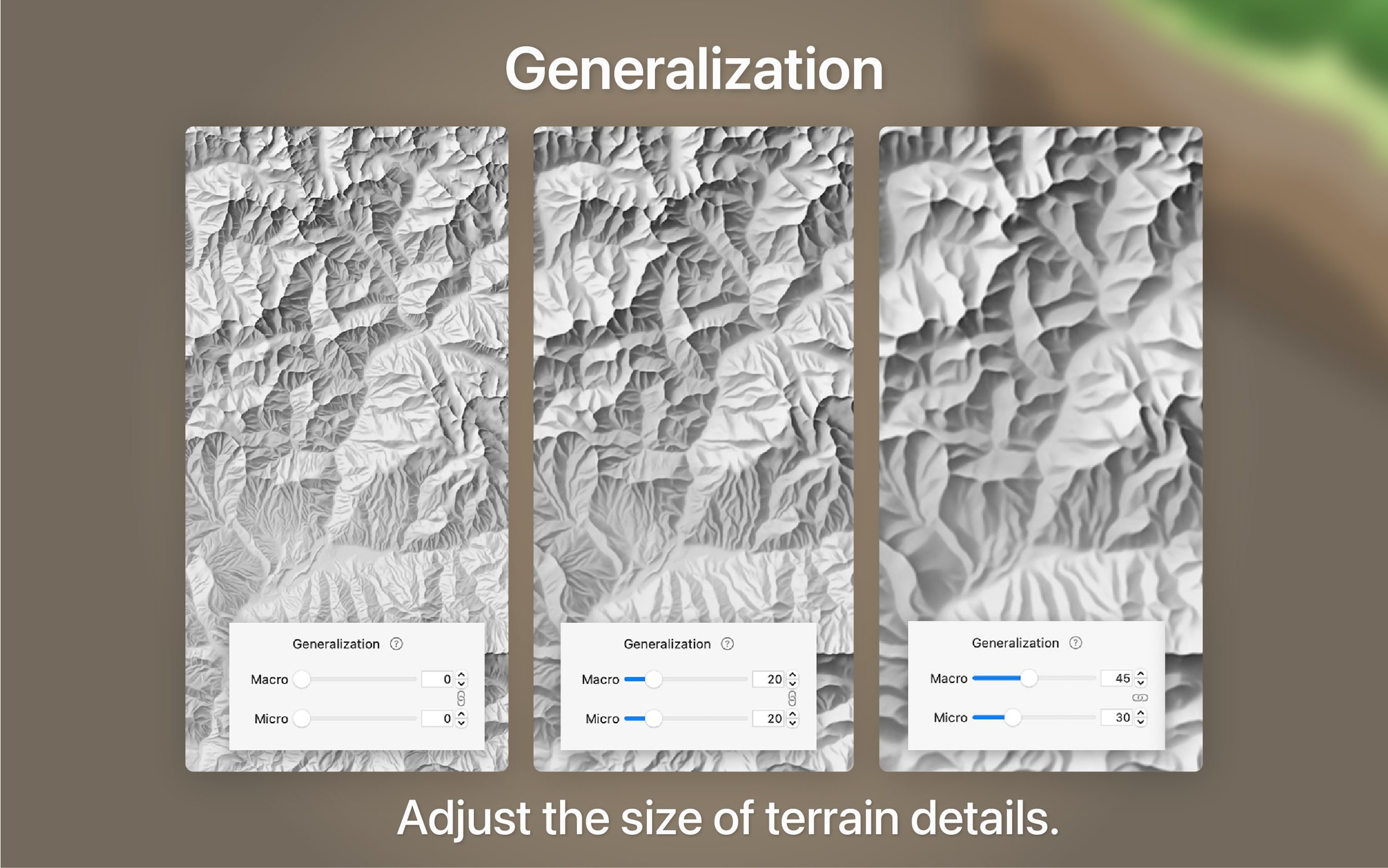
- Apply different levels of terrain generalisation (highly detailed small areas to less detailed large areas)
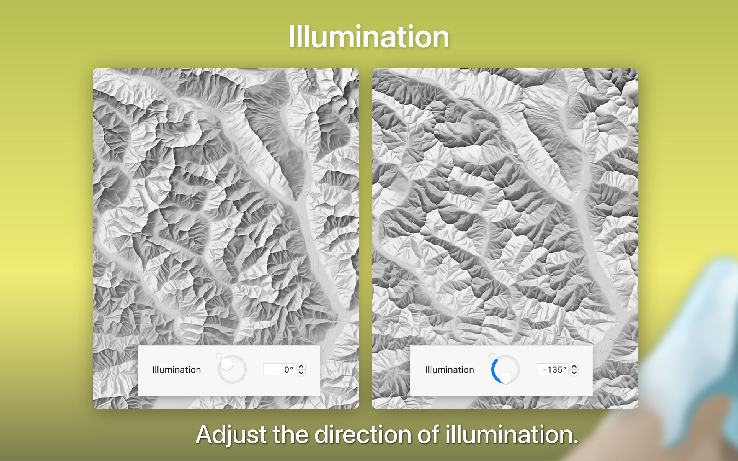
- Set the overall direction of illumination
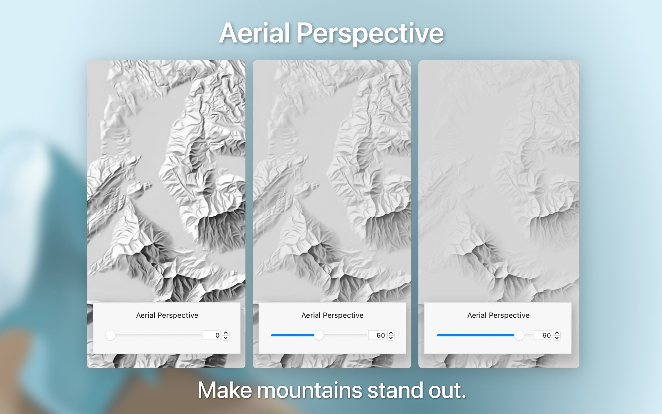
- Change the aerial perspective to make mountain peaks stand out or give all landforms the same prominence
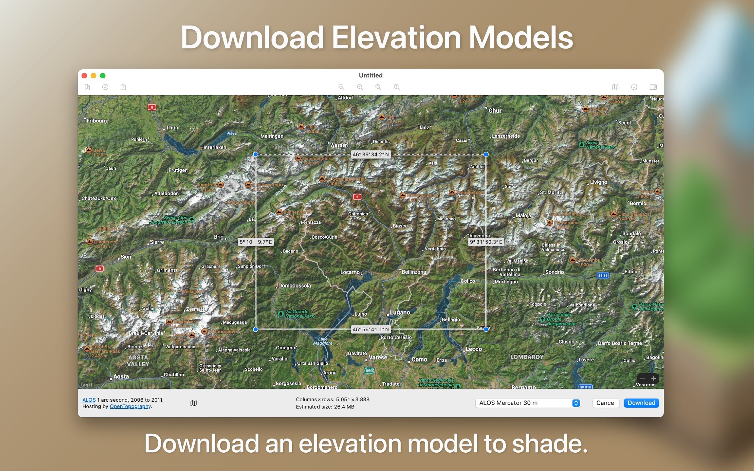
- Easily download elevation data from almost anywhere on Earth
- Pick from 3 ML models: large, medium, and small scale
- Support for all the common elevation file formats
- And much more!
The maps look beautiful, the app also looks pretty neat, but you might be wondering what is 'relief shading'? and why is our approach noteworthy?
Relief Shading 101
It's a method for representing terrain on maps in an intuitive way, at it's best it allows map readers to quickly interpret topographic elements going from large mountain ridges to small gullies. Likely without realising it you've already come across it on hilly areas in Google Maps, it is much more easily visualised than explained (drag the slider to see):
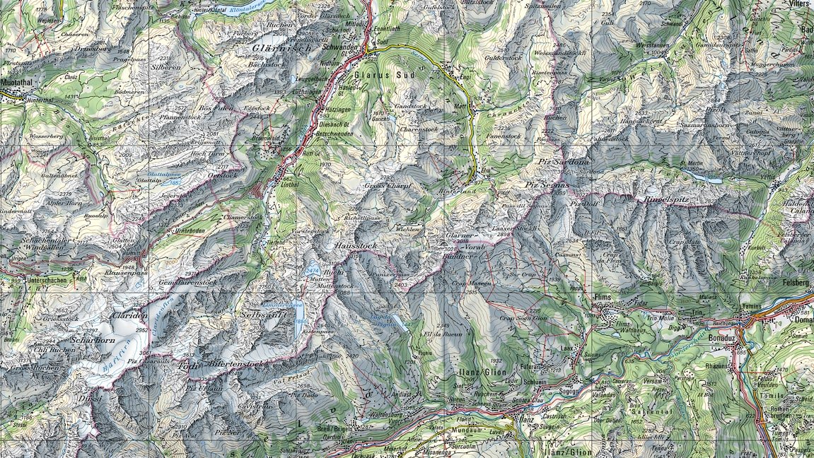
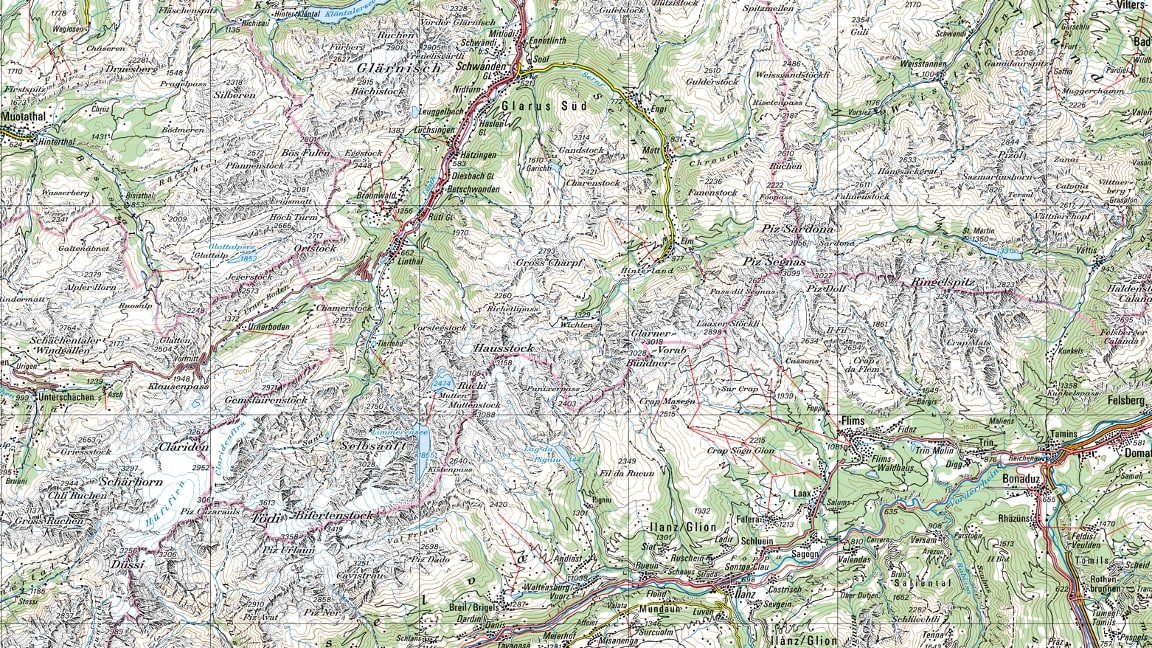
Although shaded relief images look beautiful, they aren't meant to be used standalone. Shaded relief is used in conjunction with other map elements in order to provide a 3-D surface look to a 2-D map. Creating high-quality reliefs requires specialised expertise as these are hand crafted by skilled cartographers. Switzerland’s national mapping agency swisstopo, considered the gold standard in topographic maps, scan their manually created shaded reliefs for digital use.
Many standard shading algorithms exist for creating shaded reliefs, some can easily be found in applications like ArcGIS and QGIS but they are simply not expressive enough (see our paper for examples). Creating these reliefs is partially an art form rather than a simple illumination problem, so trying to encode the 'human-ness' into step-by-step algorithms is simply too difficult. This is where ML enters the picture.
Hello Machine Learning
After extensive experimentation and collaboration with our colleagues over at ETH Zurich, we trained a U-Net to go from digital elevation models (DEMs) into beautiful shaded reliefs. The network was able to learn key design principles from manual reliefs such as removing unnecessary terrain details, adjusting illumination direction, and varying brightness to emphasise larger landforms. To confirm the high quality of the reliefs produced, we conducted a study with 18 experts in the field and their results showed that our ML-generated reliefs were of exceptional quality (see our paper for comparisons).
As our training data is Switzerland heavy, we are aware of the limitations of the network, especially when it comes to very flat terrain. However, we have equipped Eduard with features to address these limitations—you have the ability to accentuate features even in these challenging cases, making it possible to produce high-quality reliefs regardless of the terrain.
Try It Out
We've put a lot of work into the app, and hope that it'll be of use to some of you out there. The app is available on the Mac App Store and there is Demo version available on our website (includes a pre-loaded elevation model you can play with!).
We welcome feedback, please reach out at 'info (at) eduard.earth'.